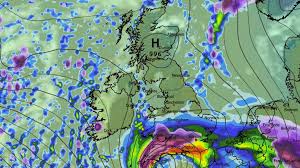
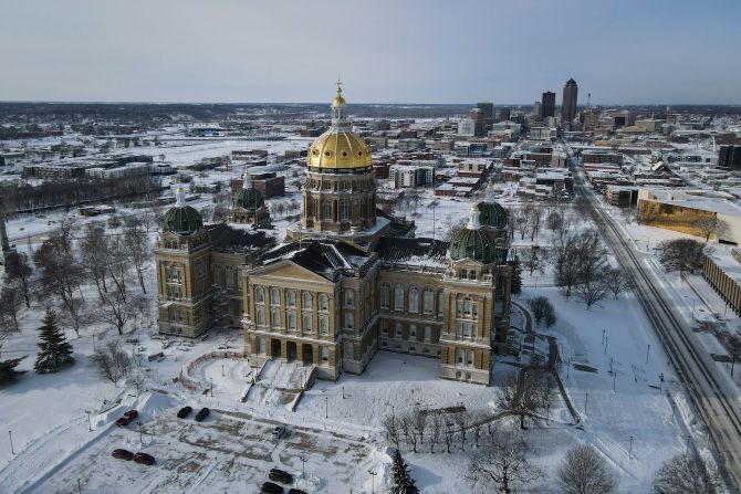
A fast-deepening winter storm dubbed Storm Goretti is driving a fresh round of amber weather warnings, disruptive snowfall, and widespread transport headaches across parts of the UK and western Europe this week. Forecasters say the system is a multi-hazard event—bringing heavy snow on its northern edge, strong winds, and bouts of rain and ice depending on location and elevation, with the highest disruption risk focused from Thursday night into Friday (January 8–9, 2026).
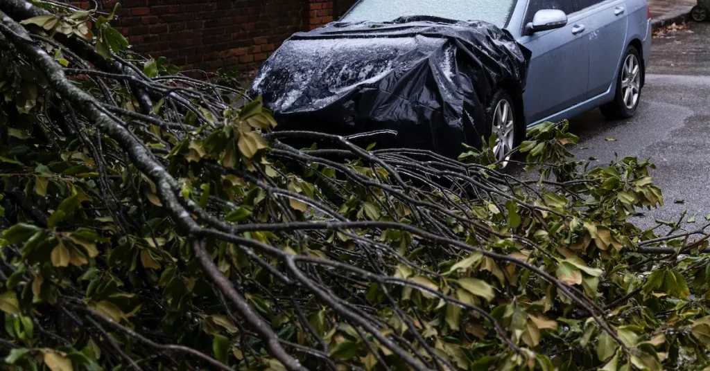
Across the UK, the Met Office says the ongoing cold spell is being reinforced by a deep low-pressure system, adding more snow and wind into an already tricky setup for roads, rail lines, and schools. In northern Scotland, severe wintry conditions have already led to power outages and major local disruption, while further south, warnings expand as Goretti approaches.
On the continent, the same broad weather pattern is blamed for major flight cancellations and rail disruption across western Europe—highlighting how one powerful winter system can ripple through air travel, cross-border trains, and commuter networks.
What is Storm Goretti—and why is it causing so much disruption?
Storm Goretti is the named low-pressure system at the center of the latest surge of wintry weather. The Met Office describes it as a “multi-hazard” event, because different parts of the system bring different problems:
-
Heavy snow (especially over higher ground and on the storm’s colder/northern flank)
-
Strong winds capable of drifting snow and worsening visibility
-
Ice and freezing rain risk where temperatures hover near 0°C
-
Heavy rain on the milder/southern edge, which can worsen travel conditions and add to hazards
This mix is exactly what makes winter storms so difficult to manage: the forecast can be accurate overall while the “rain-to-snow line” shifts by a small distance—changing impacts from slushy roads to heavy accumulation and drifting.
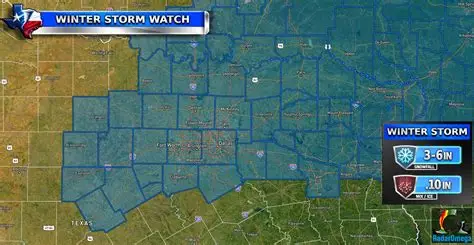
Latest warnings and expected timing
The Met Office confirms amber warnings have been issued as Storm Goretti moves into the UK’s weather picture, with a broader envelope of yellow warnings surrounding the highest-risk zones. Forecast briefings highlight the greatest disruption potential Thursday evening through Friday morning.
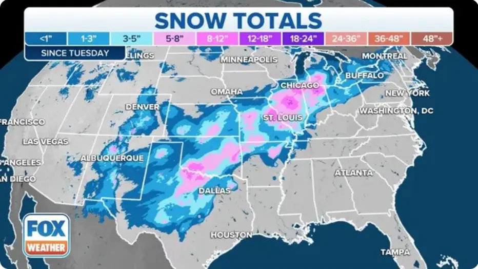
Data table: Storm Goretti alerts and impacts (January 2026)
| Area | Alert level | Main hazards | Most likely impact window | What to expect |
|---|---|---|---|---|
| North West England & Midlands | Amber | Heavy snow, ice, drifting | Thu afternoon/night → Fri | Difficult driving, delays/cancellations on rail, school disruption possible networkrailmediacentre.co.uk+1 |
| Wales (esp. higher ground) | Yellow to higher-risk pockets | Snow, wind, ice | Thu evening → Fri | Accumulations on hills; travel delays; local route closures possible The Independent+1 |
| South West England (coastal) | Yellow (wind) | Strong winds, coastal hazards | Thu → Fri | Travel disruption and hazardous conditions in exposed coastal areas euronews |
| Northern Scotland (ongoing cold spell impacts) | Yellow/Severe wintry conditions | Snow/ice, isolation risk | Ongoing into midweek; then further impacts possible | Closures, power issues, severe rural travel difficulty The Guardian+1 |
| Western Europe (aviation/rail hubs) | National advisories | Snow, wind, ice | Midweek into late week | High flight cancellation risk, delays, de-icing constraints, rail disruption Reuters+1 |
Travel chaos: rail, roads, and airports hit hard
UK rail: “Check before you travel”
In the UK, transport operators are preparing for disruption as amber snow warnings cover large areas and conditions intensify. Network Rail has warned passengers—particularly in parts of the North West and High Peak—to check services before setting out, while teams treat tracks, platforms, and key points with de-icer in anticipation of snow and ice. networkrailmediacentre.co.uk
On top of that, the wider cold snap has already disrupted rail and local travel in parts of Scotland, with service suspensions and difficult road conditions in northern areas. The Guardian+1
Europe: mass cancellations and cross-border disruption
Across western Europe, the stormy pattern has driven large-scale flight cancellations at major hubs—most notably Amsterdam’s Schiphol, where hundreds of flights were called off amid heavy snow and wind. Reuters+1
Reuters also reported major disruption in France and the Netherlands, including flight reductions ordered by French aviation authorities at Paris airports and broader road restrictions in parts of France due to hazardous conditions. Reuters
Euronews described the knock-on effect on travellers as the system pushes across multiple countries, with snow and ice warnings and continuing disruption to trains and flights. euronews
Why this matters for readers: once aviation schedules start collapsing at big hubs, delays cascade across Europe—affecting connecting flights, baggage systems, crew rotations, and even rail services as travellers switch modes.
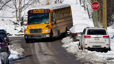
Schools and services: closures, remote learning guidance, and community impacts
The cold spell surrounding Storm Goretti has also pushed schools into difficult decisions—especially in regions where travel is unsafe, buses can’t run, or sites can’t be safely heated and staffed.
The Guardian reported hundreds of school closures across parts of the UK amid widespread snow and ice, with further disruption expected as Goretti arrives. The Guardian+1
ITV noted UK Department for Education guidance that when schools do close due to severe weather, they should consider remote learning where feasible until reopening is safe. ITVX
In northern Scotland, the severe conditions have become especially serious in some areas—reportedly including power outages and impacts to rural access, adding pressure to local authorities and emergency planning. The Guardian
What areas are most at risk in the UK?
Forecast briefings highlight a familiar winter-storm pattern: the worst snow risk often concentrates over higher ground, with drifting where winds strengthen. Reporting on the warning footprint indicates snow risk spanning parts of Wales, the Midlands, and western/southern England, with the largest disruption risk in the amber areas during the overnight window.
A key uncertainty is exact track—a small shift changes where the heaviest snow sets up and where rain dominates. That’s why forecasters stress checking updated warnings frequently through Thursday and Friday.
Practical safety checklist for Storm Goretti
If you’re driving
-
Avoid non-essential travel during the peak window (Thu night–Fri morning) in warned areas.
-
Pack essentials: charged phone, warm layers, blanket, water/snacks.
-
Assume untreated roads may have black ice, especially in rural and shaded routes
If you rely on trains
-
Check operator updates before leaving and expect last-minute changes.
-
Allow extra time for station access, as platforms and footpaths can be icy.
If you’re flying in Europe
-
Watch for early airline notifications and rebooking options; hub disruption can cascade fast.
-
Consider flexible travel plans—especially if you’re connecting through major airports.
For families
-
Monitor local school notices and be ready for remote learning or delayed reopening.
What happens next: forecast outlook
Meteorologists expect the pattern to remain volatile as colder air interacts with attempts by milder Atlantic air to push in—one reason forecasters warn of ongoing uncertainty and the potential for further snowfall risks in the days following the main Goretti window.
For readers, the takeaway is simple: Storm Goretti isn’t just a one-night story. Even after the core passes, lingering ice, residual snow cover, and secondary weather pulses can keep disruption elevated—especially for morning commutes and school operations.


Leave a Comment