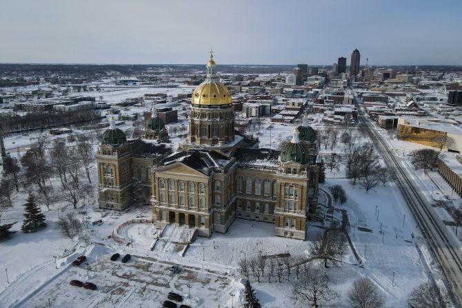
As forecasts for this weekend’s winter storm spread days in advance, anticipation and concern are growing across large parts of the country.
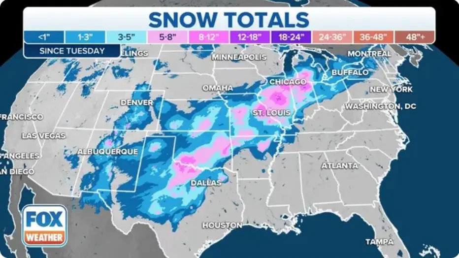
Predicted snowfall ranges from a few inches to more than a foot, with icy conditions possible from Texas to New England, depending on where the storm ultimately tracks.
Before the first flake hits the ground, weather models, social media, and headlines have already fueled widespread discussion.
To better understand why major winter storms often become big news early, UVA Today spoke with Christine Hall, an assistant professor in the Department of Natural Sciences at the University of Virginia’s College at Wise.
WHY WINTER STORMS GENERATE EARLY BUZZ
Winter storms tend to capture public attention earlier than many other weather events.
Unlike thunderstorms or tornadoes, snowstorms often develop slowly, allowing forecasters to detect potential impacts days in advance.
This longer lead time creates space for projections to evolve and, at times, fluctuate significantly.
According to experts, early forecasts are meant to raise awareness, not guarantee specific outcomes.
UNDERSTANDING THE SCIENCE BEHIND SNOW FORECASTS
Forecasting winter storms is complex because small atmospheric changes can dramatically affect snowfall totals.
Temperature variations of just one or two degrees can mean the difference between rain, sleet, ice, or heavy snow.
Christine Hall explained that long-range models are valuable for identifying risk zones but not precise accumulation amounts.
Snowfall predictions become more reliable as the storm gets closer and data resolution improves.
TIMELINE: HOW THIS WEEKEND’S STORM TOOK SHAPE
Early Model Signals
Meteorologists began noticing a strong upper-level disturbance several days before the weekend.
Midweek Forecast Expansion
Snowfall estimates increased, and the potential impact zone widened from the southern Plains to the Northeast.
Late-Week Adjustments
Models showed significant variability, with totals shifting by region and elevation.
Final Forecast Window
Confidence levels increase within 24 to 48 hours of the storm’s arrival.
OFFICIAL EXPERT INSIGHT FROM UVA
Christine Hall emphasized that early storm hype is often driven by uncertainty rather than certainty.
She noted that social media amplification can magnify worst-case scenarios before meteorologists finalize details.
Hall explained that forecasters intentionally communicate potential ranges to prepare emergency managers and the public.
These early alerts help people plan, even if exact totals later change.
WHY SNOW TOTALS VARY SO WIDELY
Snow accumulation depends on several factors working together at the same time.
Moisture availability, storm speed, temperature profiles, and ground conditions all play a role.
A slower-moving storm can dump significantly more snow than a fast-moving one.
Likewise, warmer ground temperatures can reduce accumulation even during heavy snowfall.
PUBLIC REACTION: EXCITEMENT, SKEPTICISM, AND CONCERN
Public response to winter storm forecasts tends to fall into three categories.
Some people express excitement, especially in regions where snow is rare.
Others remain skeptical, citing past storms that underdelivered.
Meanwhile, emergency officials and utilities focus on preparation rather than speculation.
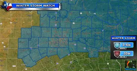
WHAT THIS STORM COULD MEAN ACROSS REGIONS
Southern States
Areas like Texas could see rare wintry precipitation, including ice.
Midwest and Appalachians
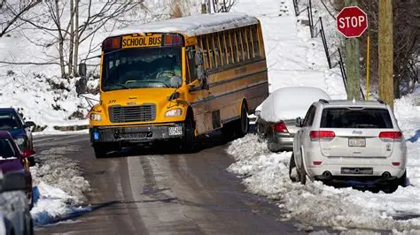
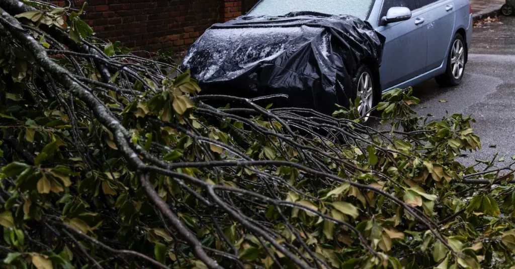
Snow and mixed precipitation may affect travel and power infrastructure.
Northeast and New England
Colder temperatures increase the likelihood of accumulating snow.
Officials stress that impacts will vary widely by location.
WHAT HAPPENS NEXT AS THE STORM APPROACHES
Forecast confidence will increase as meteorologists receive updated satellite and radar data.
Winter storm watches may transition to warnings in higher-risk areas.
Travel advisories and school or event decisions typically follow within 24 hours of onset.
Residents are encouraged to monitor official forecasts rather than rely on early projections alone.
KEY FACTS SUMMARY
| Category | Details |
|---|---|
| Event | Anticipated winter storm |
| Location | Texas to New England |
| Date | This weekend |
| Who Is Affected | Millions across multiple regions |
| Current Status | Forecast models evolving |
| What Readers Should Know | Early forecasts show wide uncertainty |
FREQUENTLY ASKED QUESTIONS
Is this weekend’s winter storm guaranteed?
No. Forecast confidence improves closer to the event.
Why do snow forecasts change so often?
Small temperature and track shifts can dramatically alter outcomes.
Is early forecasting helpful or harmful?
Experts say it helps with preparation, despite uncertainty.
Should people prepare now?
Monitoring forecasts and having basic supplies ready is recommended.
Will all regions see snow?
Some areas may see rain or ice instead, depending on conditions.
When will forecasts be most accurate?
Typically within 24 to 48 hours of the storm.
CLOSING
As winter storm forecasts continue to evolve, experts urge the public to focus on preparedness rather than precise snowfall totals.
Early projections are designed to raise awareness, not predict exact outcomes days in advance.
Residents should watch updated forecasts as the weekend approaches and be ready to adjust plans as conditions become clearer.


Leave a Comment