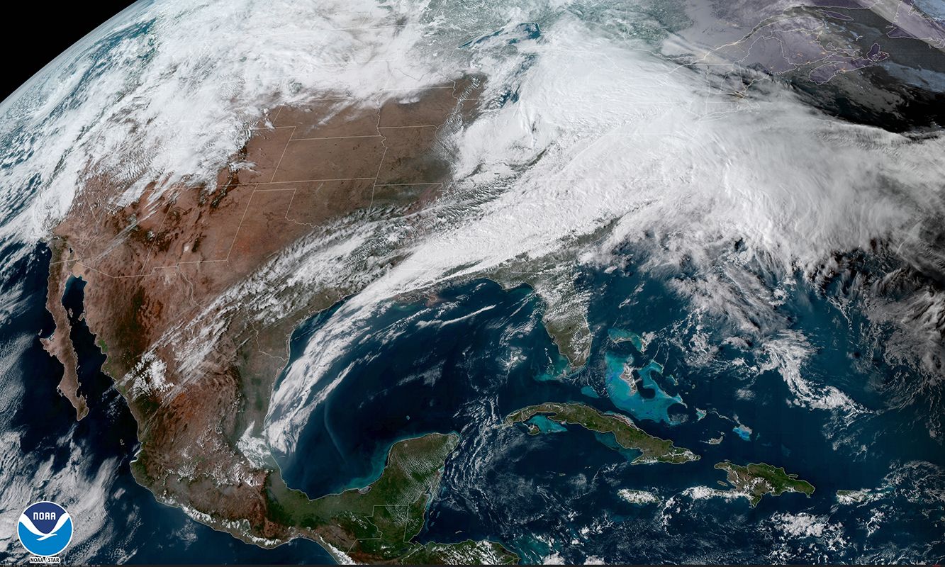
A powerful winter storm is expected to take shape off the East Coast this weekend, and early forecasts suggest it could strengthen rapidly into a bomb cyclone.
Meteorologists say the system should develop near the Carolinas early Saturday before moving north over the Atlantic. Where it goes from there is still unclear.
That uncertainty matters. A modest shift in the storm’s track could be the difference between heavy snow in major East Coast cities or little more than a cold, windy stretch.
Forecasters caution that confidence remains low for now and that the picture should sharpen later this week.
A Strong Offshore Storm Signal Is Emerging
Forecast models are increasingly aligned on the storm’s formation, even if they disagree on the details.
As of midweek, both U.S. and European models show a low-pressure system developing offshore Saturday morning. Once established, the storm is expected to intensify quickly as it moves over warmer Atlantic waters and interacts with a deep pool of Arctic air to the west.
If the storm’s central pressure drops by at least 24 millibars in 24 hours, it would qualify as a bomb cyclone — a type of storm known for producing strong winds, heavy precipitation, and hazardous marine conditions.
“This is a classic setup for rapid intensification offshore,” said Bob Oravec, lead forecaster with the National Weather Service’s Weather Prediction Center. “But the exact impacts inland depend heavily on how close the storm tracks to the coast.”

Why the Storm’s Track Is the Biggest Question
Right now, the storm’s path is the primary source of forecast uncertainty.
Some model runs keep the system well offshore, limiting snowfall and keeping the strongest winds over open water. Other scenarios bring the storm closer to the coastline, increasing the risk of snow, gusty winds, and coastal impacts from the Carolinas to New England.
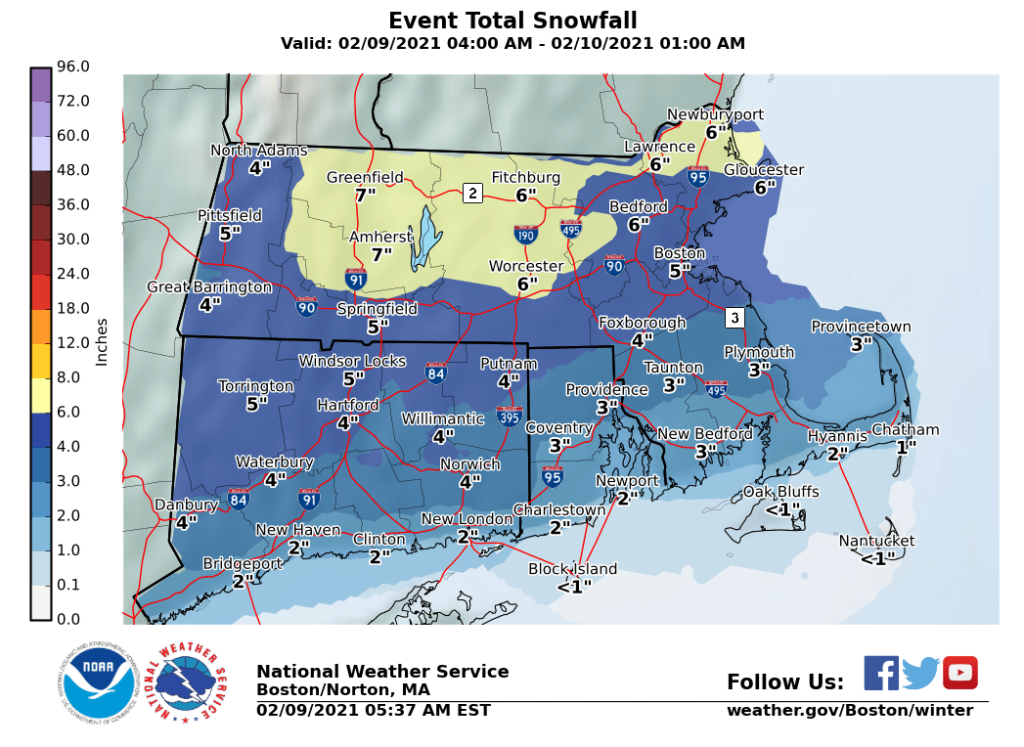
Meteorologists say a shift of just 100 to 200 miles could significantly change outcomes for densely populated cities along the Interstate 95 corridor, including Washington, Baltimore, Philadelphia, New York, and Boston.
“When storms intensify this quickly, small changes early on can have outsized effects later,” said Judah Cohen, director of seasonal forecasting at Atmospheric and Environmental Research. “That’s why confidence is still evolving.”
Bitter Cold Already Covers the Eastern U.S.
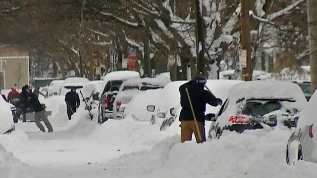
The storm would arrive as much of the eastern United States remains locked in a prolonged cold spell.
Arctic air has settled across the region, with subzero wind chills reported earlier this week in parts of the Midwest, Appalachians, and interior Northeast. That cold air mass provides the temperature contrast needed for explosive storm development offshore.
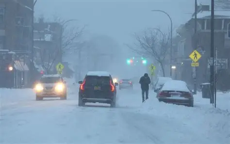
Even areas that avoid significant snowfall could still feel impacts through strong winds and dangerous cold.
With temperatures well below freezing, any precipitation that does fall inland would likely be snow rather than rain.
What Forecasters Are Watching Day by Day
Through Wednesday and Thursday, meteorologists expect forecast models to continue adjusting as new atmospheric data is incorporated.
That process often leads to noticeable swings in storm track and intensity several days out, making early snowfall maps unreliable.
By Friday, the storm will be closer in time, allowing higher-resolution models to better resolve where the heaviest impacts may land.
“If the guidance starts to cluster, confidence will rise quickly,” said Oravec. “That’s when we can start talking more specifically about snow potential.”
The storm is expected to form early Saturday and intensify through the weekend, with any impacts likely peaking late Saturday into Sunday.
Officials Urge Caution, Not Conclusions
Weather agencies are emphasizing patience as interest in the storm grows.
While forecasters acknowledge a strong signal for development, they stress that it is too early to draw firm conclusions about snowfall totals or city-by-city impacts.
Emergency managers and transportation officials are monitoring forecasts but have not issued widespread winter storm warnings.
Meteorologists caution that early social media graphics and single-model projections often overstate confidence at this range.
Public Attention Is Growing, But So Is Caution
Across the East Coast, residents are paying close attention as forecast discussions circulate online.
Model maps showing heavy snow have begun to spread on social media, though forecasters continue to warn that those images can change quickly.
Many local officials are taking a measured approach, noting that decisions about school schedules, travel advisories, or closures typically wait until forecast confidence improves.
What Impacts Are Most Likely Right Now
Some outcomes are more certain than others.
Forecasters are confident that a strong storm will intensify offshore and that marine conditions along the Atlantic coast will become hazardous. Gusty winds are also likely near coastal areas.
What remains uncertain is how far inland those impacts reach, which cities see accumulating snow, and how long any disruptions last.
Snowfall projections are expected to change multiple times before the weekend.
What Comes Next
Meteorologists will focus on how upper-level energy interacts with surface features over the next several days.
If forecast models begin to agree on a consistent track, confidence in snow and wind impacts will increase quickly.
Until then, forecasters recommend following official updates and avoiding decisions based on early projections.
Key Facts at a Glance
| Category | Details |
|---|---|
| Event | Potential bomb cyclone |
| Location | Off the U.S. East Coast |
| Expected timing | Saturday–Sunday |
| Who is affected | East Coast residents, coastal communities |
| Current status | Developing, forecast confidence remains low |
| What readers should know | Small track changes could lead to very different impacts |
Frequently Asked Questions
What is a bomb cyclone?
A bomb cyclone is a storm that rapidly strengthens when air pressure drops at least 24 millibars in 24 hours.
When could this storm form?
Forecast models show development early Saturday off the Carolinas.
Will major cities see snow?
It’s too early to say. Small shifts in the storm’s track could change outcomes significantly.
Why is forecast confidence still low?
The storm is several days away, and models have not yet converged on a single solution.
Could this become a major winter storm?
It has that potential, but impacts remain uncertain.
When will forecasts improve?
Confidence should increase by Friday as the storm moves closer.
Closing
Forecast guidance continues to point toward a powerful storm developing off the East Coast this weekend, but the details are still coming into focus.
For now, uncertainty is the story. A relatively small change in the storm’s track could lead to very different outcomes across the region.
Forecasters say clearer answers should arrive later this week, as the atmosphere reveals where this storm is truly headed.


Leave a Comment