Water naturally flows downhill—it’s one of the most fundamental principles we learn in physics class. Yet along the expansive Colorado Plateau, a major tributary of the Colorado River appears to defy this basic law of nature, flowing “uphill” for more than 100 miles across some of the West’s most dramatic terrain. For decades, this geographical anomaly puzzled scientists and casual observers alike, but recent geological discoveries may finally explain this remarkable phenomenon.
The Mysterious Journey of the Green River
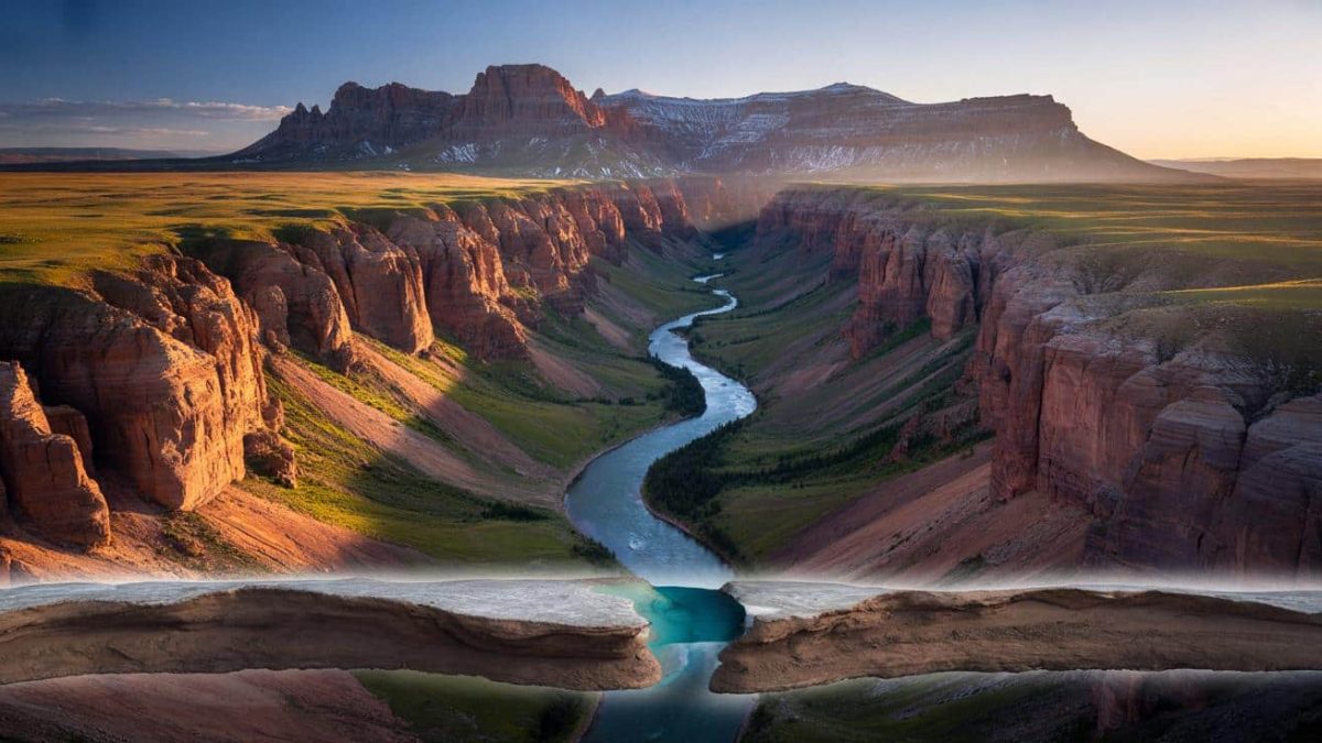
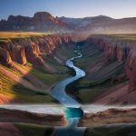
The Green River, which stands as the largest tributary feeding into the Colorado River system, exhibits behavior that initially seems to contradict everything we understand about hydrology. Beginning its journey in the Wind River Mountains of Wyoming, this vital waterway travels southward through Utah, eventually merging with the Colorado River near Moab. The puzzling aspect emerges when examining the river’s path through the Colorado Plateau region, where the water appears to flow uphill against the general slope of the landscape for an extended distance.
This counterintuitive flow pattern became a subject of intrigue for geologists and hydrologists who recognized that something more complex than basic gravity was at work. The river’s behavior challenged conventional understanding and prompted decades of investigation into the underlying geological forces shaping the region’s topography and water systems.
Understanding the Elevation Paradox
The key to understanding this phenomenon lies in examining the actual elevation changes along the Green River’s path. When mapped precisely, the river doesn’t actually flow uphill in the physical sense—water cannot move uphill without external energy input. Instead, what appears to be uphill movement is actually a consequence of how the surrounding landscape has been shaped and deformed over millions of years.
The Colorado Plateau itself is not a uniform, gradually sloping surface. Rather, it’s a complex region of uplift, subsidence, and structural deformation where different geological blocks have risen and fallen at different rates. The Green River’s path reflects these ancient movements, creating the illusion of uphill flow when examined against the surrounding topography.
Tectonic Forces Reshaping the Landscape
Modern geological research, particularly studies utilizing advanced mapping technologies and detailed stratigraphic analysis, has illuminated the role of tectonic activity in creating this unusual situation. The Colorado Plateau experiences ongoing vertical movements driven by deep crustal forces. As certain regions experienced uplift while others subsided, the river continuously adjusted its course to maintain its flow toward lower elevations.
The Green River essentially carved its path through rising landscape features. As the terrain around the river’s established course elevated, the river maintained its downward gradient by cutting through the rising rock formations rather than seeking an alternative route around them. This created the appearance of flowing uphill when viewed on modern topographic maps, which show the current elevation of the land without considering the river’s continuous adjustment over millions of years.
The Role of River Antecedence
Geologists have increasingly focused on a concept known as river antecedence—the idea that established rivers can maintain their courses even as geological structures rise beneath them. The Green River became established in its present location during an earlier geological period when the landscape configuration was different. As tectonic forces gradually raised the plateau around the river’s path, the river’s erosive power allowed it to cut downward through the rising rock layers, maintaining its original course.
This process, occurring over tens of millions of years, created a situation where the river now flows through deeply incised canyons while the surrounding landscape has risen significantly. The result is a river that appears to flow upward when examined against modern surface elevation, yet maintains a consistent downhill gradient when considering water’s actual flow direction relative to sea level and gravitational pull.
Advanced Technologies Revealing the Truth
Contemporary geological tools have provided unprecedented clarity on this mystery. High-resolution elevation data, satellite imagery, and sophisticated computer modeling have allowed scientists to reconstruct the region’s geological history and understand how the Green River’s path developed. Radiometric dating of rocks along the river’s course has helped establish timelines for the region’s uplift and the river’s response to changing conditions.
Researchers have also employed techniques examining river sediment patterns and canyon wall geology to trace the river’s historical path. These investigations consistently demonstrate that the river has maintained a persistent course downward, even as the surrounding landscape rose around it—a testament to the power of flowing water in reshaping Earth’s surface over geological timescales.
Implications for Understanding Geological Processes
The Green River’s apparent uphill flow serves as a remarkable natural laboratory for understanding how rivers interact with dynamic geological landscapes. This case study has implications for interpreting similar patterns in mountain ranges worldwide and for comprehending how continental uplift affects drainage systems.
The phenomenon also illustrates how our perspective matters in interpreting natural features. What appears anomalous from one viewpoint becomes perfectly logical when examined within the proper geological framework. Understanding the region’s structural history and tectonic movements provides the context needed to comprehend why the river behaves as it does.
A Testament to Geological Complexity
The Green River’s seemingly impossible flow pattern ultimately demonstrates the intricate complexity of Earth’s geological processes. Rather than defying physics, the river operates according to fundamental principles while the landscape itself has undergone dramatic transformations. The river’s path represents a historical record preserved in stone, telling the story of uplift, erosion, and the persistent power of water to shape mountains and plateaus.
As geological science continues advancing, mysteries like this one provide opportunities for researchers to deepen their understanding of how tectonic forces, erosion, and hydrology interact across geological timescales. The Green River flows onward, its waters carrying the story of the Colorado Plateau’s dynamic past toward future generations of scientists eager to read nature’s geological record.


Leave a Comment