A winter storm warning will take effect Friday afternoon as a powerful system moves across the state, bringing the potential for measurable snowfall and dangerously cold temperatures.
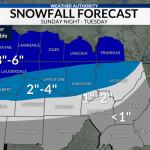
Forecasters say snow accumulation of 3 inches or more is possible in many areas, along with wind gusts ranging from 25 to 35 mph.
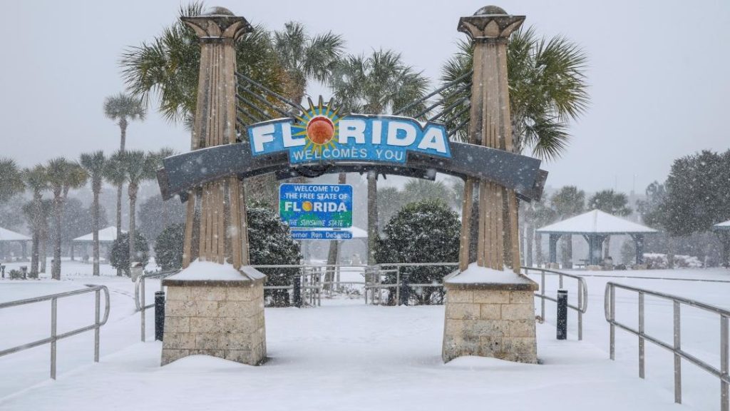
The storm is expected to affect travel, outdoor plans, and daily routines statewide as temperatures drop below freezing through the weekend.
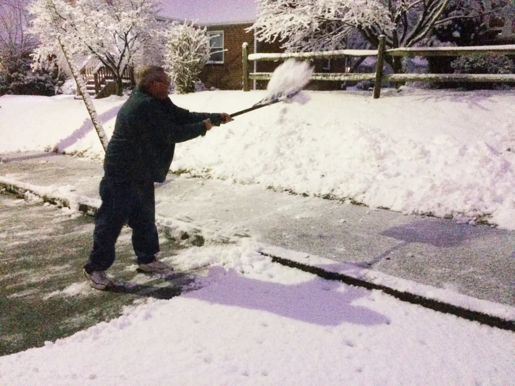
Officials are urging residents to prepare early, monitor forecasts closely, and limit unnecessary travel once conditions deteriorate.
Winter Storm Warning Issued Ahead of Weekend System
The National Weather Service has issued a winter storm warning beginning Friday afternoon, signaling an increased risk of hazardous winter conditions across the state.
The warning covers most regions and remains in effect through the weekend as a fast-moving but potent storm system brings snow, wind, and sharply colder air.
Meteorologists say this system has the potential to create widespread impacts due to the combination of accumulating snow and gusty winds.
Even areas that typically see lighter snowfall could experience slick roads and reduced visibility during peak periods.
What’s Driving This Storm System
Forecasters say the incoming storm is fueled by a strong upper-level disturbance pulling cold Arctic air southward.
As moisture moves into the region, temperatures will be cold enough to support snow rather than rain across much of the state.
Wind gusts of 25 to 35 mph are expected, which could lead to blowing snow and drifting in open areas.
Those winds will also push wind chills well below freezing, increasing the risk of frostbite for anyone exposed for extended periods.

Timeline: How the Weekend Weather Is Expected to Unfold
Friday afternoon:
Winter storm warning goes into effect. Snow begins developing in western and central areas late in the day.
Friday night:
Snow becomes more widespread. Accumulations begin increasing as temperatures fall below freezing statewide.
Saturday:
Periods of snow continue. Wind gusts increase, reducing visibility at times and making travel hazardous.
Saturday night into Sunday:
Snow tapers off gradually, but cold air remains locked in. Temperatures stay below freezing, allowing icy conditions to persist.
Sunday:
Skies begin to clear in some areas, but cold temperatures and lingering slick spots remain a concern.
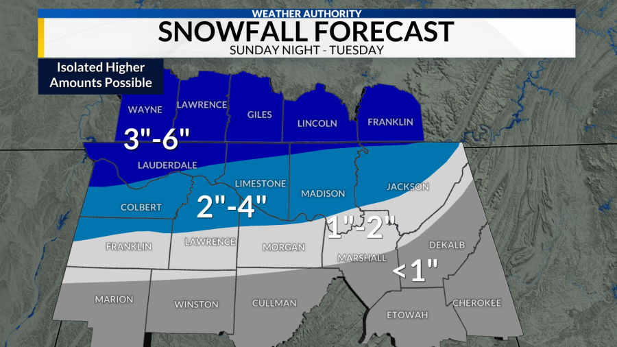
Expected Snowfall and Wind Impacts
Forecast models indicate that many areas could see at least 3 inches of snow, with localized higher totals possible depending on band placement.
Strong winds will play a major role in how the storm is experienced on the ground.
Blowing and drifting snow may reduce visibility on highways and rural roads, especially during overnight and early morning hours.
Power disruptions are not expected to be widespread, but isolated outages cannot be ruled out where winds and snow combine.
Why Below-Freezing Temperatures Matter After the Snow
Even after snowfall ends, the cold air behind the system will keep temperatures below freezing for much of the weekend.
This increases the likelihood that untreated roads, bridges, and sidewalks remain icy.
Melting during the day followed by refreezing at night could create additional hazards for drivers and pedestrians.
Officials warn that conditions may appear improved while still being dangerous.
Official Statements and Safety Messaging
Weather officials emphasized that this storm meets warning criteria due to expected accumulation, wind, and cold.
Emergency management agencies are encouraging residents to complete preparations before Friday afternoon.
That includes checking vehicles, stocking emergency supplies, and planning for potential travel disruptions.
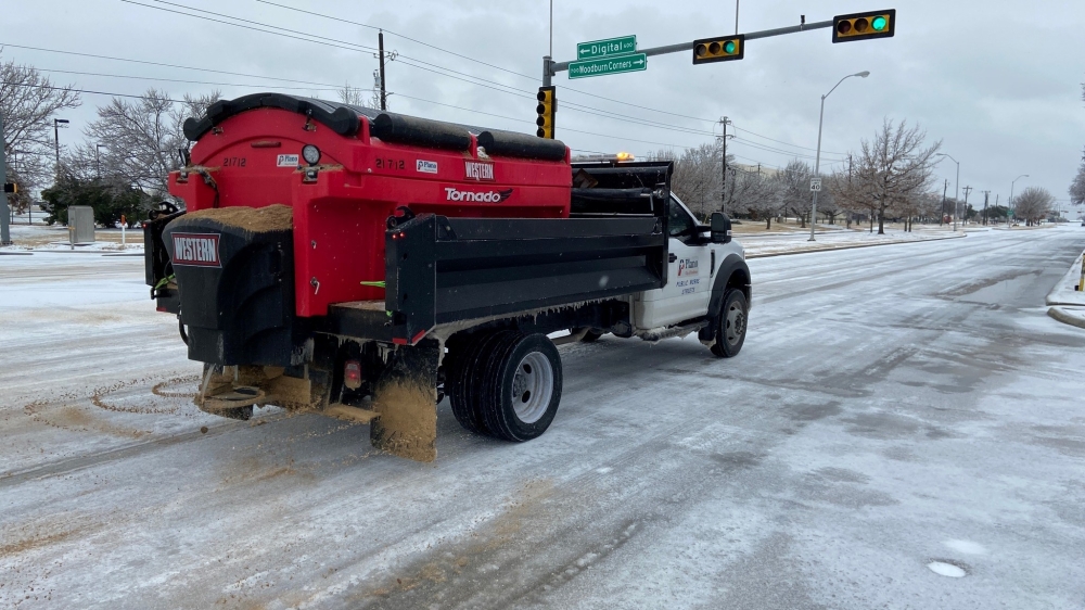
Transportation crews are expected to pre-treat major roadways where conditions allow.
Public Reaction and Early Preparations
As the warning was issued, residents began adjusting weekend plans and preparing for winter conditions.
Grocery stores and fuel stations reported increased activity ahead of the storm.
Some schools, churches, and community organizations began reviewing contingency plans for weekend events.
Local officials said early preparation helps reduce emergency response needs once conditions worsen.
Travel and Infrastructure Concerns
Road conditions are expected to deteriorate quickly once snowfall begins.
Wind-driven snow may make it difficult for plows to keep up in some areas.
Officials advise avoiding unnecessary travel during the height of the storm, especially Friday night and early Saturday.
Air travel may also be impacted, with delays possible depending on snowfall rates and wind conditions.
What Happens Next
Meteorologists will continue refining snowfall forecasts as the system approaches.
Any adjustments to warning areas or timing will be communicated through official weather channels.
After the storm exits, attention will shift to how long cold temperatures persist and whether additional systems could follow.
Residents are encouraged to stay informed through the weekend.
KEY FACTS SUMMARY
| Event | Winter storm warning issued |
|---|---|
| Location | Statewide |
| Date | Friday afternoon through the weekend |
| Who is affected | Residents, travelers, businesses |
| Current status | Warning active |
| What readers should know | Snow, wind, and cold will create hazardous conditions |
FREQUENTLY ASKED QUESTIONS
How much snow is expected?
Many areas could see 3 inches or more, with localized higher totals possible.
When does the winter storm warning start?
The warning goes into effect Friday afternoon.
Will winds make conditions worse?
Yes. Gusts of 25 to 35 mph could cause blowing snow and reduced visibility.
How cold will it get?
Temperatures will remain below freezing through the weekend, with dangerous wind chills at times.
Should travel be avoided?
Officials recommend limiting travel during the storm, especially overnight Friday and early Saturday.
How long will impacts last?
Snow may end by Sunday, but icy conditions could persist due to cold temperatures.
CLOSING
A winter storm warning is now in effect as measurable snow, strong winds, and below-freezing temperatures are expected statewide this weekend.
Residents are urged to prepare early, monitor weather updates, and use caution on roads and walkways as conditions develop and persist through the weekend.


Leave a Comment