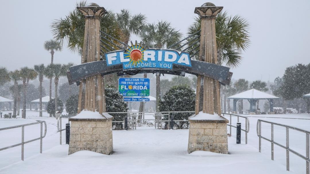
Florida’s west coast could see a rare winter sight this week as a powerful cold front pushes into the state, bringing the possibility of snow or wintry mix to areas unaccustomed to frozen precipitation.
Forecasters say the approaching system is unusually strong for late January, with Arctic air plunging south behind the front and temperatures dropping sharply across much of Florida.
While any snowfall would likely be brief and light, the setup is drawing attention because of how far south the cold air is expected to reach — including parts of the Gulf Coast.
The cold front is also expected to bring the lowest temperatures Florida has seen in years, increasing the chance of record-breaking cold across the peninsula.
Why Snow Is Being Mentioned in Florida
Snow in Florida is rare, especially outside the Panhandle. But meteorologists say this system has several ingredients that make wintry precipitation at least possible along the west coast.
Cold air will surge into the region at the same time moisture lingers over the eastern Gulf of Mexico. If temperatures drop quickly enough while precipitation is still falling, rain could briefly mix with sleet or snow in isolated areas.
The highest chances appear to be north of Tampa, particularly in inland or elevated areas, though forecasters stress that confidence remains low.
Even so, the mention of snow underscores just how cold this air mass is.
Timing: When the Cold Front Arrives
The cold front is expected to sweep through Florida late this week, with the sharpest temperature drop occurring overnight.
Behind the front, strong north winds will pull much colder air into the state, sending overnight lows well below seasonal averages.
By early morning, some areas along Florida’s west coast could see temperatures cold enough for frost, freezes, or brief wintry precipitation if moisture is still present.
The coldest conditions are expected late night into early morning, when surface temperatures are lowest.
What Parts of Florida Are Most at Risk
North and Central Florida will feel the cold first and most intensely, with freezing temperatures likely in inland areas.
Along the west coast, communities from the Nature Coast south toward the Tampa Bay area could experience the sharpest contrast, shifting from mild conditions to near-freezing temperatures in a matter of hours.
Farther south, including Southwest Florida, snow is unlikely, but unusually cold temperatures and gusty winds are still expected.
The Florida Keys will avoid freezing conditions but will still see some of the coldest air of the season.
Why This Cold Front Is Unusual
Florida regularly sees cold fronts during winter, but this one stands out for both its strength and reach.
Meteorologists say the Arctic air mass behind the front is colder than what typically reaches the Gulf Coast, especially this late in the season.
The system follows a period of well-above-average warmth, making the temperature swing even more noticeable.
In some areas, highs could struggle to reach the 40s or 50s just days after temperatures were near record levels.
What Officials Are Advising
Emergency managers and weather officials are urging residents to prepare for cold conditions rather than focusing on the slim snow potential.
That includes protecting sensitive plants, checking outdoor plumbing, and planning for cold mornings.
Boaters along the west coast are also being warned about strong winds and rough marine conditions behind the front.
Drivers are advised to remain alert during early morning hours, especially in inland areas where bridges and overpasses could become slick if temperatures fall quickly.
What Happens Next
Forecasters will continue refining the forecast as the cold front moves closer and confidence increases on how much moisture lingers behind it.
Even if snow does not materialize, the cold itself is expected to have widespread impacts across the state.
Temperatures should begin to moderate gradually after the coldest air settles in, though chilly mornings may linger into the weekend.
Residents across Florida are encouraged to monitor updated forecasts and advisories as conditions change.


Leave a Comment