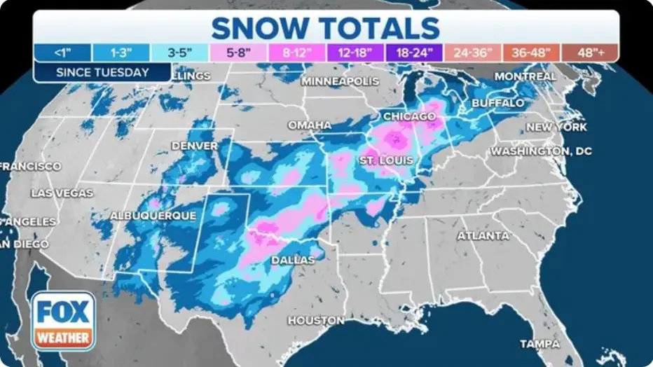
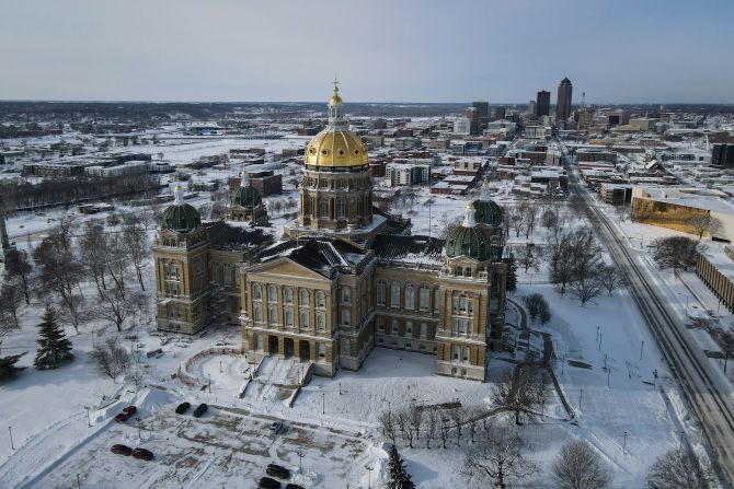
A potentially high-impact winter storm is taking shape for this weekend, prompting growing concern among forecasters and emergency planners.
Winter precipitation is expected to begin during the day Saturday and continue through at least Sunday evening, with conditions deteriorating as the system intensifies.
While precipitation may start light, meteorologists warn that deep atmospheric moisture could quickly lead to heavier rates of snow, sleet, or ice.
The storm’s timing and intensity could significantly affect travel, especially on untreated roads, making preparation critical for residents and travelers.
Winter Storm Threat Increases Heading Into the Weekend
Forecasters are closely monitoring a developing winter storm system expected to impact the region from Saturday through Sunday.
Early indications suggest the event will unfold in phases, beginning with lighter precipitation before intensifying later Saturday.
By Saturday night, conditions could worsen rapidly as deep moisture feeds into the system.
Meteorologists say this setup increases the risk for heavier precipitation rates and more dangerous travel conditions.
What’s Driving This Weekend’s Winter Weather
The storm is being fueled by a strong surge of moisture interacting with cold air near the surface.
As this moisture deepens, it creates an understood risk for prolonged precipitation rather than a brief winter event.
Forecasters note that the type of precipitation remains a key uncertainty, with snow, sleet, and freezing rain all possible.
Even small temperature differences could determine whether areas see manageable snowfall or more dangerous ice accumulation.
Timeline: How the Storm Is Expected to Unfold
Winter precipitation is expected to begin Saturday during the daytime hours.
Initially, precipitation may be light and scattered, which could give a false sense of limited impact.
Conditions are forecast to worsen Saturday evening as moisture deepens and precipitation rates increase.
The heaviest impacts are expected between 8 p.m. Saturday and 5 p.m. Sunday, when travel conditions may be at their worst.
Precipitation is expected to continue into Sunday evening before gradually tapering off.
Heaviest Precipitation Expected Saturday Night Through Sunday
Meteorologists say the most concerning window of the storm will occur overnight Saturday into much of Sunday.
During this time, heavier precipitation rates could overwhelm road treatments and snow removal efforts.
If freezing rain becomes dominant, even short periods of icing could make roads extremely hazardous.
Officials emphasize that impacts will depend heavily on how much ice forms compared to snow or sleet.
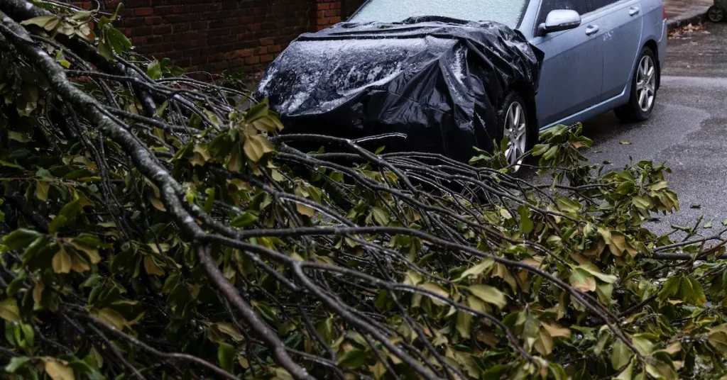
Why Ice Could Be the Biggest Threat
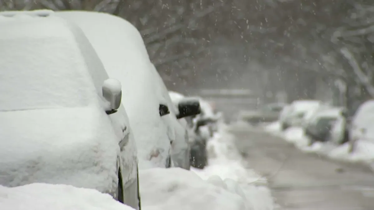
While snow can slow travel, ice poses a much greater danger.
Freezing rain can coat roads, bridges, and sidewalks with a thin, nearly invisible layer of ice.
Untreated surfaces could become impassable, especially during periods of heavier precipitation.
Forecasters warn that travel may become difficult or even impossible in areas that experience significant icing.
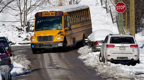
Travel Impacts Could Be Severe
Travel is expected to be the primary impact of this winter storm.
Road conditions could deteriorate quickly, particularly Saturday night and Sunday.
Officials caution that untreated roads, secondary highways, and rural routes will be most vulnerable.
Drivers are urged to avoid unnecessary travel during the height of the storm and to plan ahead if travel cannot be postponed.
Background: A Pattern Favoring Winter Storms
This system is part of a broader winter weather pattern that has remained active in recent weeks.
Repeated surges of cold air combined with available moisture have created multiple opportunities for winter precipitation.
Forecasters say this weekend’s storm stands out due to its duration and potential for heavier precipitation rates.
Longer-lasting storms often result in more significant impacts, even if totals remain uncertain.
Official Messaging Focuses on Preparedness
While no single agency statement defines the storm yet, meteorologists and emergency managers are emphasizing preparedness.
Officials urge residents to monitor forecasts closely as details are refined.
Travel advisories or winter weather alerts may be issued as confidence in impacts increases.
Emergency management officials often recommend preparing for power disruptions and travel delays during ice-prone events.
Public Reaction: Caution and Planning Ahead
Residents across the region are beginning to adjust weekend plans as forecasts evolve.
Many are opting to complete errands earlier in the week or delay travel altogether.
Online discussions reflect growing concern about ice potential, particularly for Sunday travel.
Families and businesses alike are watching forecast updates closely before making final decisions.
PROPER NEWS TABLE: Key Facts at a Glance
| Category | Details |
|---|---|
| Event | Increasing winter storm threat |
| Location | Regional impacts expected |
| Date | Saturday through Sunday |
| Who is affected | Drivers, travelers, residents |
| Current status | Forecast monitoring ongoing |
| What readers should know | Ice could make travel dangerous or impossible |
How Residents Can Prepare Now
Emergency planners recommend preparing before precipitation begins.
Drivers should ensure vehicles are winter-ready and avoid travel during peak impact periods.
Households may want to prepare for potential disruptions by having food, water, and essential supplies on hand.
Staying informed through official forecasts and alerts is strongly encouraged.
What Happens Next as Forecasts Update
Meteorologists will continue refining the forecast as the storm approaches.
Confidence in precipitation type and impact zones is expected to increase closer to Saturday.
Additional advisories or warnings may be issued if the threat of ice or heavy snow becomes clearer.
Residents should expect forecast updates through the weekend as conditions evolve.
FREQUENTLY ASKED QUESTIONS
When will winter precipitation start?
Precipitation is expected to begin Saturday during the daytime hours.
When will conditions be at their worst?
The most significant impacts are expected between Saturday evening and Sunday afternoon.
What type of precipitation is expected?
Snow, sleet, and freezing rain are all possible, depending on temperatures.
Why is ice such a major concern?
Ice can make roads nearly impassable, especially on untreated surfaces.
Should travel plans be adjusted?
Yes. Travel may become difficult or impossible during peak storm periods.
Will forecasts change?
Yes. Details will be refined as the storm approaches.
CONCLUSION
A potentially high-impact winter storm is expected to affect the region this weekend, with increasing risks from heavy precipitation and possible ice.
While precipitation may begin lightly, conditions are forecast to worsen significantly from Saturday night through Sunday.
Travel impacts could be severe, particularly if ice becomes the dominant precipitation type.
Residents are encouraged to stay informed and watch for updated forecasts and advisories as the weekend approaches.


Leave a Comment