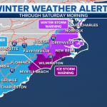
A developing coastal storm is drawing close attention across the Carolinas as forecasters warn it could bring a rare round of deep snow to parts of the region.
The system, still organizing offshore, has the potential to track close enough to deliver accumulating snowfall, especially in areas that do not often see significant winter weather.
If the storm strengthens and follows its projected path, impacts could include difficult travel, school disruptions, and power concerns in communities not built for heavy snow.
Emergency managers and residents are now watching forecasts closely as details continue to come into focus.
COASTAL STORM COULD BRING SNOW TO THE CAROLINAS
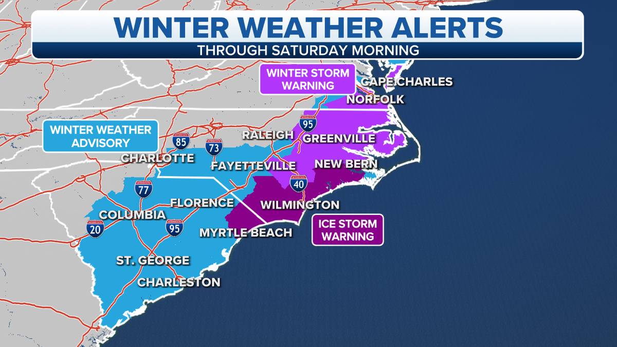
Meteorologists say a coastal low-pressure system developing along the southeastern coastline could set the stage for a notable winter weather event in North and South Carolina.
Coastal storms of this type can rapidly intensify as they move northward, pulling in moisture from the Atlantic while interacting with colder air already in place inland. When conditions align, the result can be heavy, wet snow well outside the typical snow belt.
Forecast models suggest the storm’s eventual track will be critical in determining who sees snow, rain, or a mix. A slight shift east or west could dramatically change impacts across the Carolinas.
WHY THIS STORM HAS FORECASTERS PAYING ATTENTION
Snow events in the Carolinas are uncommon, but not unprecedented. When they do occur, they often create outsized impacts due to limited snow-removal infrastructure and drivers unaccustomed to icy roads.
This particular storm stands out because of the amount of moisture available and the possibility of cold air holding firm over the region long enough for snow to accumulate.
Even modest snowfall totals can disrupt daily life across the Carolinas. Heavier bands, if they develop, could lead to significant travel problems and localized power outages.
BACKGROUND: HOW COASTAL STORMS CREATE SNOW IN THE SOUTH
Coastal winter storms, sometimes referred to as nor’easter-type systems when they move farther north, form when a strong temperature contrast exists along the East Coast.
Cold air moving south meets warmer, moisture-rich air from the Atlantic. As the storm strengthens offshore, precipitation spreads inland.
In the Carolinas, elevation, distance from the coast, and surface temperatures often determine whether precipitation falls as snow, sleet, or rain. Inland and higher-elevation areas typically have the highest snow potential.
TIMELINE: WHAT HAPPENS NEXT WITH THE STORM
Early Development
The storm is expected to organize offshore, drawing energy from the temperature contrast along the coast.
Approach to the Carolinas
As the system moves northward, precipitation could begin spreading inland, initially as rain or mixed precipitation in coastal areas.
Peak Impact Window
If colder air remains in place, snow could develop or intensify across interior portions of North and South Carolina.
Storm Exit
The system is expected to move away, with lingering cold air potentially leading to icy conditions even after precipitation ends.
Forecast confidence will increase as the storm draws closer and more data becomes available.
WHAT OFFICIALS ARE SAYING
State and local officials across the Carolinas are urging residents to remain alert as forecasts evolve.
Emergency management agencies say they are monitoring weather updates and preparing contingency plans in case travel conditions deteriorate.
Transportation officials have also noted that bridges and elevated roadways would be especially vulnerable to freezing conditions if snow or sleet develops.
While no widespread closures have been announced, authorities emphasize that preparation time matters, especially in regions that rarely experience winter storms of this scale.
POTENTIAL IMPACTS ACROSS THE CAROLINAS
If the storm tracks close enough, impacts could include:
-
Snow-covered and icy roadways, especially inland
-
Travel delays on interstates and secondary roads
-
School and government office closures
-
Isolated power outages due to heavy, wet snow
-
Disruptions to flights at regional airports
Urban areas, which retain heat longer, may see lower totals, while rural and elevated areas could experience greater accumulation.
PUBLIC REACTION AND PREPARATIONS
Residents across the Carolinas have already begun preparing as forecasts circulate.
Hardware stores report increased interest in ice melt, flashlights, and batteries. Grocery shoppers are also making routine storm preparations, particularly in areas that remember past winter disruptions.
On social media, many residents are sharing memories of previous rare snowstorms, while others express concern about driving conditions and school schedules.
Local governments are using official channels to discourage panic buying while encouraging reasonable preparation.
WHY EVEN A FEW INCHES CAN BE A BIG DEAL
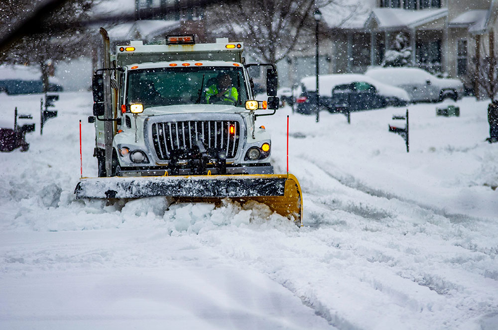
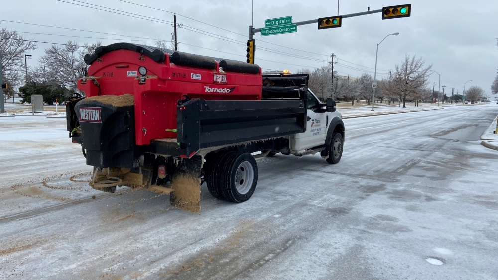
Unlike northern states, much of the Carolinas lacks extensive snow-removal equipment. A small number of plows must cover large areas.
Road treatments can be limited, and freezing temperatures overnight can turn slush into ice quickly.
Because of this, even snowfall amounts considered minor in other parts of the country can create major disruptions in the Southeast.
WHAT HAPPENS NEXT FOR RESIDENTS
Meteorologists stress that details will continue to change until the storm is closer.
Residents are advised to:
-
Monitor local weather forecasts
-
Avoid unnecessary travel during peak storm hours
-
Prepare for possible school or work schedule changes
-
Check on vulnerable neighbors if conditions worsen
Officials say clear communication will continue as confidence increases.
KEY FACTS TABLE
| Category | Details |
|---|---|
| Event | Potential coastal winter storm |
| Location | North Carolina and South Carolina |
| Date | Developing system, timing to be confirmed |
| Who is affected | Residents, commuters, schools, travelers |
| Current status | Monitoring and forecast updates ongoing |
| What readers should know | Snow potential depends on storm track and temperatures |
FREQUENTLY ASKED QUESTIONS
Will it definitely snow in the Carolinas?
Not yet. Snow depends on the storm’s exact track and surface temperatures.
Which areas are most at risk for snow?
Inland and higher-elevation areas typically have the highest chance.
Could coastal areas see snow?
Coastal locations are more likely to see rain or a mix, but colder air could allow brief snow.
When will forecasts become more certain?
Confidence usually improves 24 to 48 hours before the storm arrives.
Should residents prepare now?
Officials recommend basic winter preparedness without panic.
Could this impact schools or work schedules?
Yes. Even limited snowfall can lead to closures in the region.
CLOSING
A developing coastal storm has placed the Carolinas on alert for the possibility of deep snow, an uncommon but impactful event for the region.
While uncertainty remains, the days ahead will bring clearer forecasts and guidance. Residents are encouraged to stay informed, monitor official updates, and prepare for changing conditions as the system evolves.


Leave a Comment