
Dangerous cold is not done with south-central Pennsylvania just yet.
Arctic air has kept the region locked in well-below-average temperatures, and the worst of it is lingering into the weekend. Sub-zero wind chills are expected to continue through Saturday, making even short trips outdoors risky, especially overnight and early in the morning.
Conditions begin to change on Sunday, but not necessarily for the better right away. Winds are expected to pick up, adding another layer of discomfort before temperatures gradually rise next week. Snow chances return as the pattern shifts.
Arctic Cold Refuses to Let Go
South-central Pennsylvania has spent days under a stubborn cold dome, with little relief in sight.
Daytime highs have struggled to break out of the teens and low 20s. Overnight lows have slipped into the single digits. Add in steady wind, and the result has been repeated rounds of wind chills falling below zero.
“This has been a prolonged stretch of cold, even by winter standards,” said Jon Palmer, a meteorologist with the National Weather Service office in State College. “The cold air has been well-established, and it’s taken time for that pattern to loosen its grip.”
For residents, the cold has meant frozen pipes, higher heating demand, and limited outdoor activity.
Wind Chills Remain the Biggest Concern Through Saturday
While temperatures may wobble slightly from hour to hour, the real danger continues to come from the wind.
Forecasters say wind chills will remain well below zero through Saturday morning across much of the region, particularly in open and higher-elevation areas. Exposure for even a short time can lead to frostbite.
“When wind chills drop that low, it doesn’t take long for skin to be affected,” Palmer said. “That’s why we stress limiting time outdoors and making sure everything is covered.”
Health and emergency officials continue to urge residents to layer clothing, protect exposed skin, and keep pets indoors during the coldest stretches.
Sunday Brings Wind, Not Immediate Relief
Sunday marks a transition, though it may not feel like one.
Temperatures are expected to edge upward slightly, but increasing winds could offset any comfort. Gusts may worsen wind chills and create difficult driving conditions, especially on open highways and for high-profile vehicles.
Utility providers are also keeping an eye on the forecast.
“Strong winds combined with extreme cold can put added stress on the system,” said a spokesperson for a regional electric utility. “We’re monitoring conditions and encouraging customers to report outages promptly.”
Why the Cold Has Lasted This Long
The reason behind the extended chill lies high above the ground.
A large Arctic air mass settled across the northeastern United States, reinforced by a persistent dip in the jet stream. That setup allowed cold Canadian air to funnel south and stay put.
With little warm air able to push in, temperatures remained suppressed longer than usual for late January and early February.
Forecasters say that pattern is now beginning to weaken, though slowly.
A Gradual Warm-Up Takes Shape Next Week
Relief is coming, but it will not arrive all at once.
Early next week, temperatures are expected to climb closer to seasonal norms. Highs in the 30s and 40s would ease the risk of extreme wind chills and reduce some cold-related hazards.
Still, warmer air often brings new challenges in winter.
“As temperatures rise, we also start to see more moisture in the pattern,” Palmer said. “That opens the door for additional snow chances.”
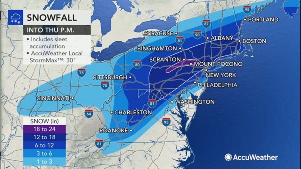
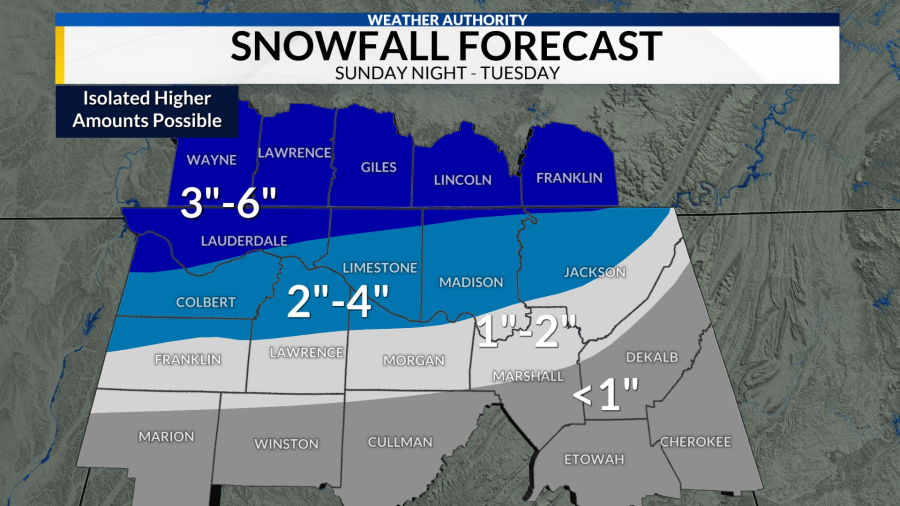
Snow Returns to the Forecast
Several systems are being watched for next week as the weather pattern becomes more active.
At this stage, forecasters say it is too early to pin down exact timing or snowfall amounts. Even so, residents are being advised to stay alert.
After prolonged cold, even light snow can create slick conditions during morning and evening commutes.
Transportation officials are urging drivers to slow down and remain flexible with travel plans as forecasts evolve.
How Residents Are Responding
Local agencies continue to focus on preparedness.
Emergency management officials are asking people to check on elderly neighbors, make sure heating systems are working properly, and keep basic supplies on hand.
Animal welfare groups are repeating familiar warnings.
“If it’s too cold for you to be outside, it’s too cold for your pet,” said a representative from a local humane society, reminding residents that animals are vulnerable to frostbite and hypothermia as well.
What to Watch Going Forward
The weekend remains hazardous, particularly through Saturday morning.
Wind will be the story on Sunday. After that, attention turns to next week’s warmer temperatures and the potential for snow.
Forecast updates will continue as conditions change.
Key Facts at a Glance
| Category | Details |
|---|---|
| Event | Prolonged sub-zero wind chills |
| Location | South-central Pennsylvania |
| Date | Through Saturday; windy Sunday |
| Who Is Affected | Residents, commuters, pets, outdoor workers |
| Current Status | Dangerous cold ongoing |
| What to Know | Wind chills below zero persist; gradual warm-up next week with snow chances |
Frequently Asked Questions
How cold will it get this weekend?
Wind chills are expected to remain below zero through Saturday, especially overnight and early morning.
Why do wind chills matter more than air temperature?
Wind strips heat from exposed skin faster, increasing the risk of frostbite.
Does Sunday improve conditions?
Temperatures rise slightly, but stronger winds keep conditions uncomfortable.
When will temperatures return closer to normal?
Early next week, with highs expected in the 30s and 40s.
Is snow likely next week?
Yes, forecasters are tracking several systems as the pattern becomes more active.
Should travel plans change?
Drivers should remain cautious, particularly during windy conditions and early mornings.
Closing
South-central Pennsylvania remains in the grip of dangerous winter cold as sub-zero wind chills persist into the weekend and winds strengthen on Sunday.
Conditions improve gradually next week, but winter hazards are not over. Residents are advised to stay informed as temperatures rise and snow chances return.


Leave a Comment